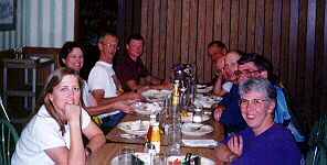
 The Butte Perkins is invaded.
After 14 days on PAC Tour, we're not sure what to think when we look at a day of 90 miles as an easy day. But that what this day was.
West Yellowstone sent us away with a gift of clear skies and brisk (but not too cold) temperatures. Considering that "West", as the locals call it, often has the lowest temperature in the nation, we considered this a blessing.
Much of the talk was of the downhill grade that we were supposed to have for almost all of the day. Though we wanted to believe this forecast, some of us couldn't completely accept it, for fear of having our expectations dashed. Because our route was generally north, we hoped, too, for the continuation of the southwest wind that has alternately nagged or helped us on many of the days past. But the map also showed our downhill was courtesy of following the Gallatin River almost all the way to Bozeman. Those of us who live in the northwest know that, unfortunately for us, winds generally blow upstream. As a result, we missed our chance at a tail wind. In our favor, though, was the swiftly descending route of the Gallatin, one of the nation's most scenic rivers and a well-known playground for white water rafting and kayaking. Since we followed the river closely, we sped downhill most of the day.
The two climbs early on turned out to be blessings, as we got a chance to warm up in the first twenty miles. Later, when the sun rose over the peaks of the Gallatin Range to our right, the resulting warmth sealed our happy fate during the "free" ride down hill. On the way up these climbs, many riders got a glimpse of a lone bison that made its way from nearby woods to the road and finally across it.
Our second rest stop was near the town of Big Sky, notable for its ski area and as the place where Chet Huntly, the well-known journalist, is buried. Our stop was in the parking lot of the small church where Huntly lies. The backdrop of the church is Lone Mountain (elevation 11, 166 feet); and on this bright, sunny day, the view made us all shake our heads in amazement. But we couldn't tarry too long for we were only half way to our destination.
While today's ride wasn't completely down hill, it was a welcome break for many of us. The end of the route featured a very rural 8-mile winding road called Gooch Hill Road (undoubtedly a Lon Haldeman find).
A highlight of the day for several of us was encountering a bison, not off in the distance, but right on the very edge of the road, on our side! To say the least, we let him have that side and took the other side to go by. Several cars had to dodge when the critter decided he wanted to graze on the other side of the road.
Thanks to a mild cold front that edged its way across SW Montana, we rode today in alternating sun and light rain. While the wet was troublesome, it more than made up for the inconvenience by clearing the air and bringing out the brilliant green seldom seen in early summer of this high country. With this being a somewhat short day, we took the chance to admire the views of rolling countryside that could be lit up with sunlight one second and then glow with softly diffused light the next. We crossed three major Montana rivers during our first 60 miles, so it seemed we rode up and down an endless (but pleasant) succession of rolling hills that took us from one drainage to the next. To our left were the Tobacco Root Mountains and several national forests, all of which made this area a pleasure to cycle through.
Lunch was in the town park of Whitehall (where no dry socks could be bought--ask Ray). But a local restaurant did have excellent pizza and bread sticks that supplemented a Susan-created hot pasta treat. About seven miles beyond town, we began the only climb of the day. This was Pipestone Pass (elev. 6418 feet). A recent rock slide had closed the road, but as Lon said, it was ok for bikes. It was a bit disconcerting to come upon workers and heavy equipment in the middle of the road and to look up a nearby cliff where they were chipping away loose rock. But we negotiated our way around them and continued our scenic climb. The grade was only about 6%, so no one suffered needlessly. With the final snack stop at the top of the climb, we had only a 3-mile descent and another 8 miles or so to our destination for the evening.
 The Butte Perkins is invaded.