The ride actually consists of two roads, Skyline Drive-a 105 mile segment from Front Royal Virginia, through the Shenandoah National Park, to Afton Virginia, and the Blue Ridge Parkway-a 469 mile long road from the southern end of Skyline Drive to Cherokee N.C. Together, they constitute what must be one of the greatest cycling roads in existence, nearly 600 miles of no red lights, stop signs, or cross streets, low speed limits, and light traffic that doesn't seem to be in a hurry to get anyplace, and no big trucks (except motor homes). The road surface was better than could reasonably be expected, smooth pavement, very little debris (occasional gravel and medium rocks). Can you imagine what it's like to ride for a week and see only one broken bottle? Both roads have innumerable paved pulloffs for scenic overlooks, which were an ideal place for rest breaks.
The only thing the roads did not have was flat terrain. It was all either uphill or downhill. I don't think the transitions even had any level ground longer than a bicycle. Nothing was very steep. The usual climbing speeds (comfortable) on the steep parts were 7 to 8 mph, and the descents were in the mid-40's (48.8 mph max). There were times, however, when we would go uphill for well over an hour. I did not obtain elevation changes for Skyline Drive, but it was equivalent to the Parkway, which had 48,601 feet of climbing, plus 1,390 feet for Mt. Mitchell.
 On Skyline Drive
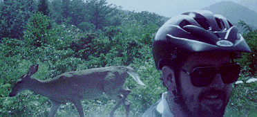 Shannon finds a friend
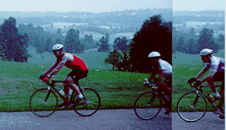 Along the ridge
 Cruising downhill
 Infrequent occurrence
 High point
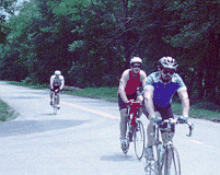 Last big climb